
(Updated 2025-10-31)
Welcome to the BEACONs GitHub page!
The BEACONs Project was founded at the University of Alberta in recognition for a new approach to conservation planning in North America’s boreal region. We are building a credible scientific framework for comprehensive land & water stewardship through the development and application of leading-edge conservation science that includes consideration of both conservation areas and lands & waters managed for other values. The premise of our research is that the ultimate goal is to identify human activities that are compatible with the maintenance of biological diversity and integrity of ecological systems. The conceptual scientific framework guiding our research is the Conservation Matrix Model.
Within these pages, we provide information on tools and methods that we use for large-scale land and water planning in the boreal region of North America, including:
- R/Shiny Apps
- R Functions
- Software
- Methods
- Project Websites
- Publications
Shiny Apps
Click the images below to redirect to repositories for each of the Shiny Apps. Disturbance Explorer and Hydrology Explorer have embedded demo datasets for trying out the tools.
| Geopackage Creator | Disturbance Explorer | Hydrology Explorer |
|---|---|---|
 |
 |
 |
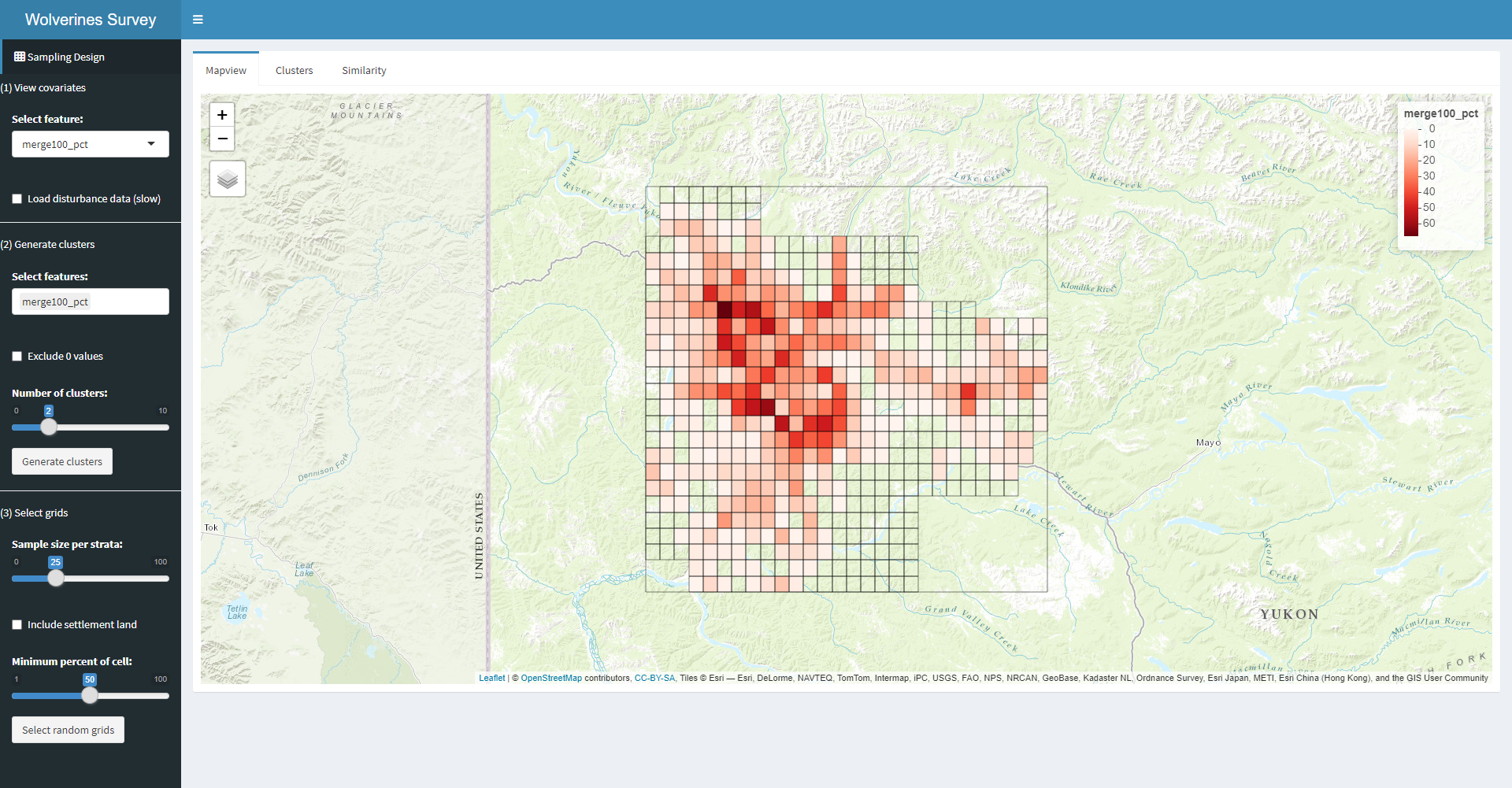
| Disturbance Validation | Wolverine Survey Design |
|---|---|
 |
 |
-
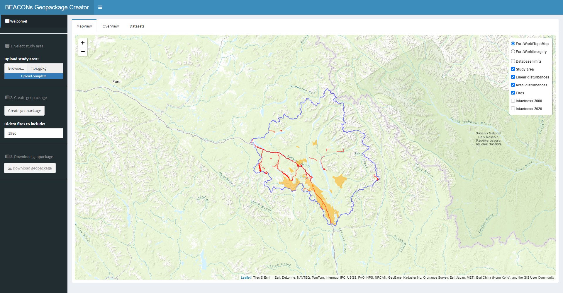
Geopackage Creator assists users with creating a geopackage file for use with the Disturbance Explorer app. Utility is presently restricted to a region intersecting the Yukon, NWT, and BC.
-
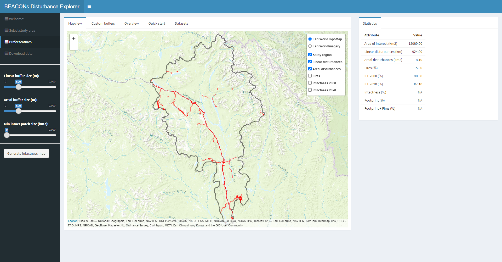
Disturbance Explorer generates human footprint or undisturbed areas maps using regional-scale human surface disturbance data.
-
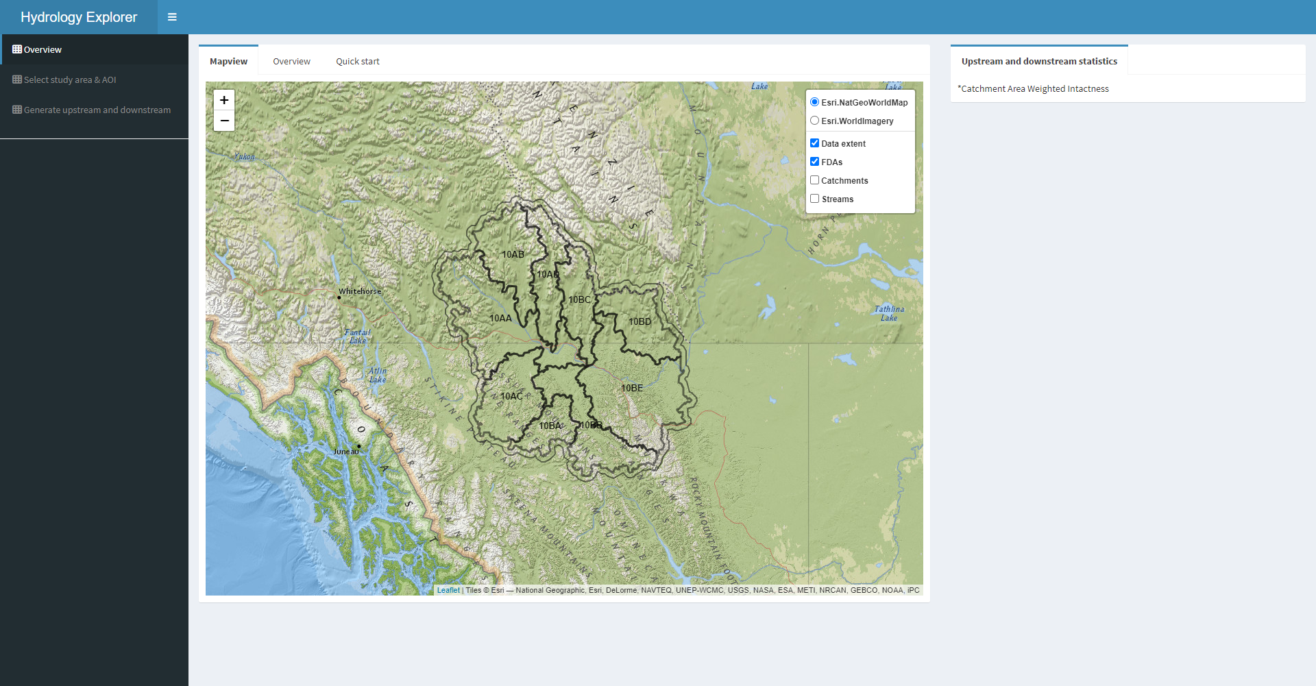
Hydrology Explorer identifies areas upstream and downstream of an area of interest (AOI; e.g., conservation area, mine site, etc.) and associated hydrologic metrics, using the BEACONs catchment dataset as building blocks.
-
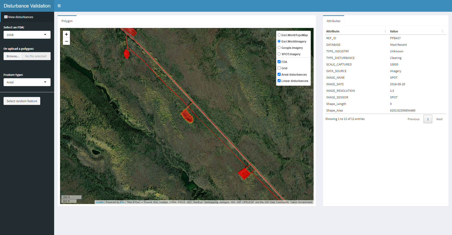
Disturbance Validation enables users to examine linear and areal surface disturbance features along with several satellite imagery sources and randomly select individual features and their associated attributes.
-
Wolverine Survey Design supports the design of a grid-based camera trap survey for wolverines and other mammals in the Dawson Region of the Yukon.
We have additional Shiny Apps under-development:
- KBA or Conservation Area Explorer: This app supports the design of new conservation areas and assembles and evaluates conservation area networks based on new and/or existing conservation areas. Functions include evaluation of intactness, size, hydrologic connectivity, upstream areas, and representation.
- Movement Mapper and Movement Explorer: These apps use animal location data to identify areas of annual & seasonal use and migration pathways.
R Functions
We will soon release a suite of R Tools that includes the following function categories:
- Builder functions generate the inputs used by Builder (see below - Software).
- Hydrology functions calculate the Dendritic Connectivity Index (Cote et al. 2009) for an area of interest (AOI) and identify areas upstream and downstream of an AOI (e.g., conservation area, mine site, etc.) using the BEACONs catchment dataset(s).
- Representation functions support assessment of representation based on targets and dissimilarity metrics (i.e., Bray-Curtis and Kolmogorov-Smirnoff).
- Spatial functions support tasks such as data preparation, spatial overlay, geometric processing, and summarization of spatial attributes.
Software
Builder is a user-friendly software application developed in C# .NET framework that assembles catchments using hydrology-based rules to identify conservation areas based on hydrologic connectivity, intactness, and size. If this software is of interest, please email beacons[at]ualberta.ca.
QGIS Plugins
We will soon release a QGIS plugin and tutorial for creating a catchment dataset with stream flow attributes that work with BEACONs’ Builder software, R functions, and Shiny Apps (e.g., Hydrology Explorer). Catchments are approximate drainage areas for stream segments and capture latitudinal and longitudinal hydrologic connectivity.
Methods
Disturbance Mapping
Project Websites
Publications (supporting material)
- Edwards et al. 2022. Conservation planning integrating natural disturbances: Estimating minimum reserve sizes for an insect disturbance in the boreal forest of eastern Canada. PLOS One Open Access, Supplemental materials
- Vernier et al. 2022. Comparing Global and Regional Maps of Intactness in the Boreal Region of North America: Implications for Conservation Planning in One of the World’s Remaining Wilderness Areas. Frontiers in Forests and Global Change, Supplemental materials
Presentations
Wolverines app (Jan 2023)
BC PARF Forum 2022 (Dec 2022)